
|
|

|

|

|

|

|

|

|
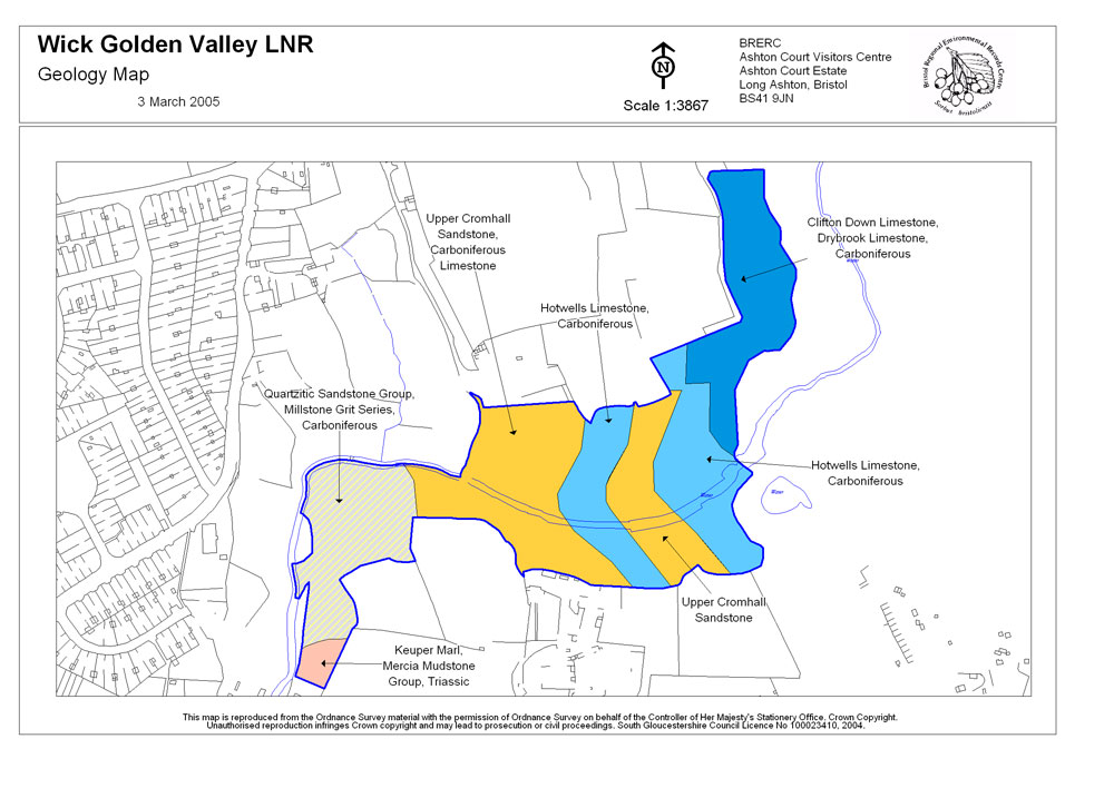
The geology of the site is shown on the geology map at the bottom of the page. For an overview of geological details, see The Geology of the Golden Valley Local Nature Reserve.
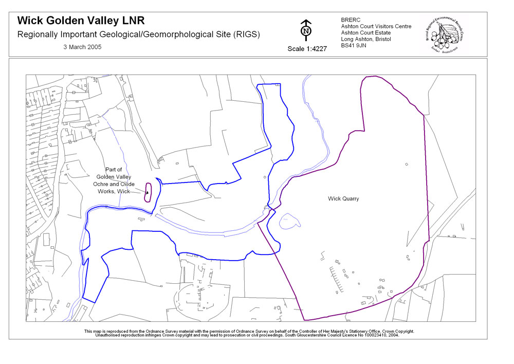
RIGS are Regionally Important Geological and Geomorphological Sites. RIGS are non-statuatory designated sites; that is, they are not protected by laws or acts of parliament. RIGS sites are instead designated by inclusion in the Local Plan of the Unitary Authority in which they fall. Local Plans are policy documents and decisions on planning applications are made in accordance with the Local Plan unless material considerations indicate otherwise. Thus, by inclusion in a Local Plan, sites such as RIGS receive a significant level of protection from unregulated disturbance or development.
RIGS are selected for their educational, research, historical and aesthetic value. Members of the Avon RIGS group collect information about geological sites in the former county of Avon (now the modern Unitary Authorities of Bath & North East Somerset, Bristol, North Somerset and South Gloucestershire) and then propose them to the relevent unitary authority for designation. If accepted, the sites are then included in the Local Plan.
The RIGS in and around Wick Golden Valley LNR are Golden Valley Ochre and Oxide Works (which has good examples of stratigraphy and petrology, as well as being of potential educational use) and Wick Quarry. For more on Wick Quarry see the Quarrying page.
These maps show the geology and geological designations in and around Wick Golden Valley LNR. For maps showing wildlife and the natural environment, please visit the Wildlife section.
These maps have been produced by Bristol Regional Environmental Records Centre (BRERC) and are available for use in line with the criteria set out in the enquiry process at www.brerc.org.uk. Information presented here was correct as of 9th February 2005, and may have been updated or changed since that time. If you are a commercial enquirer or require the latest information then please contact BRERC using the link above.
Please note that these maps are reproduced from Ordnance Survey material with the permission of Ordnance Survey on behalf of the Controller of Her Majesty's Stationery Office and are subject to crown copyright. Unauthorised reproduction infringes Crown Copyright and may lead to prosecution or civil proceedings. Maps produced under South Gloucestershire Council License number 100023410, 2004.
To view the maps, simply click on them to open a large copy in a NEW window. To save the maps, right click on them and click 'Save Target as...'
|
Geology Map |
RIGS Map |
|
|
 Geological Map of Trubody's Quarry (Part of Wick Quarry) kindly provided by Cemex
| Home Page | Main Geology Page | Contacts Page |